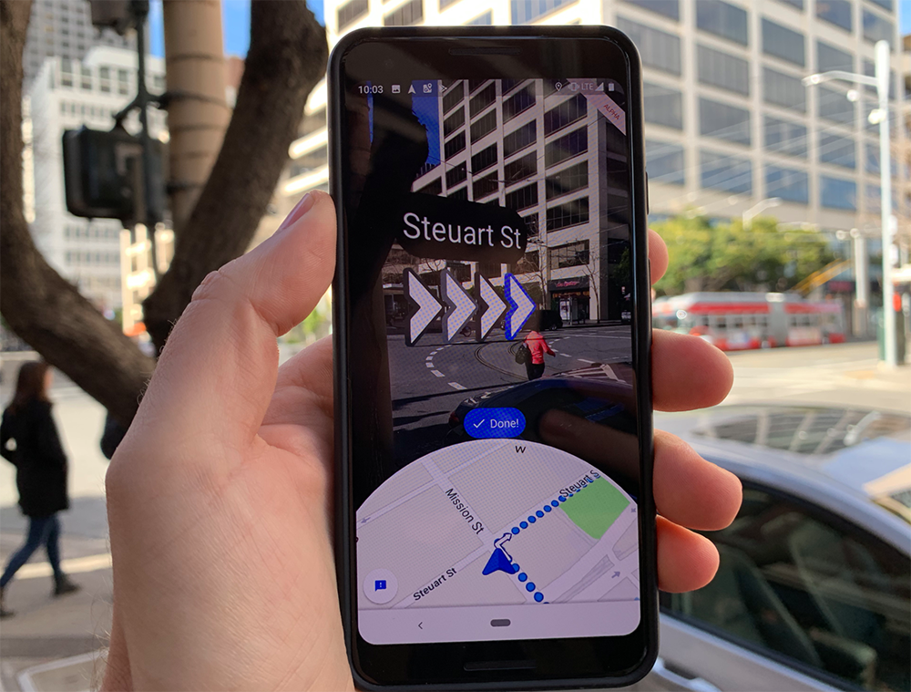
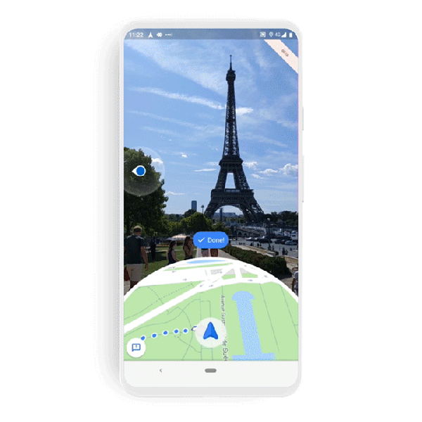
Google’s new “VPS” (visual positioning system) walking directions went live today under the name Live View. Residing within the Google Maps app for iOS and Android devices, it provides a sort of 3D interface for walking directions in urban areas.
Live View was already available to owners of newer Pixel phones and a small set of Local Guides who were essentially beta testing the product. Now it’s ready for full release with a rollout schedule over the next few weeks, depending on your device, OS and firmware (spec details below).
VPS has gotten lots of attention and keynote treatment at Google I/O because it’s a flashy feature. It utilizes computer vision to scan surroundings, which are then matched against its Street View database for object recognition. Once localized, spatially accurate directional signals are overlaid.
For now, this is purely about getting from point A to point B as a utility. In the future, some form of sponsored map pins along these routes could be integrated (this is Google after all). That will likely take a while if it happens at all, as VPS is a new use case that Google needs to test at scale.
Back to the feature’s appeal, it has all the ingredients for headlines and media interest, but the jury is still out if this will resonate with everyday users. It could gain traction among tech-forward city dwellers, which aligns with its urban use case. But education and acclimation will be needed.
Google knows this well, as it endured a painstaking design, prototyping and testing process. In fact, the company relayed those learnings in a session at Google I/O (embedded below). We recommend it to anyone with the time to watch, or interest in mobile interface design.
The short version is that GPS falters in urban canyons due to satellite signals bouncing around, thus degrading the computation of spatial positioning and inertial movement. So with VPS, Google is essentially supplementing that localization through visual recognition from Street View.
That precise localization is needed simply because an overlaid directional arrow through your phone’s viewfinder needs meter-level accuracy. The overhead Google Maps blue dot is often forgiven (begrudgingly) when it’s off by a half-block. But that won’t fly with a 3D visual interface.

Beyond the clever visual hack for device localization, the next challenge is interface design for a new form of mobile interaction that has no playbook. And that will be an ongoing process. It will also be the first large-scale experiment on consumer interest in visual interfaces for local discovery.
Another lesson here is that this is a close cousin of AR, but Google has been careful not to call it “AR” which is still too nascent and tech-sounding. Notice how Pokemon Go and Snapchat lenses (the most popular forms of AR to date) have done similar. They hardly ever say “AR.”
So this will be worth watching closely for many lessons that are applicable to mobile local commerce and beyond. We’ll keep our eye on this for its implications for local commerce and SMB marketing. But one step at a time… first it’s all about gaining the necessary consumer traction.
Live View will be available on devices that are ARCore (Android) and ARkit (iOS) compatible in countries where Street View is available.