Like a spouse who completes your sentences, Google predictively adds “near me” to just about anything you type in the search bar. It’s a natural expression of what we’re usually looking for – the most convenient service available.
Plenty of mobile apps are designed around the same concept. Friend finders, family safety apps, parking apps, electric vehicle apps, even dating apps – they all use the concept of proximity to locate the person or place that you’re looking to find.
But what does “near” really mean? It depends on the context. In a suburb, a ten minute drive to a retail store could be considered close by. In a dense urban area, that same ten minute drive is probably more like a half hour excursion when you consider parking and traffic – hardly “near me” in most people’s minds. A ten minute walk, on the other hand, is much more doable.
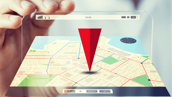
The concept of “nearness” gets a whole lot more complicated when you think beyond the flat, 2D maps used by just about every location-enabled app or service.
Say you’re at the top of the Salesforce Tower in downtown San Francisco, and you’re looking to meet up with a friend. If that friend happens to be waiting in the lobby of the Salesforce Tower, a “friend finder” app is going to return a highly misleading result. Since it can’t distinguish between your location on the sixty-first floor and your friend’s location on the first floor, it will probably say that your friend is right next to you, when in fact they’re several hundred yards below.
The pandemic gave this idea of “nearness” new meaning and importance. Seeking to improve customer experience, retail outlets and restaurants use location services in their apps to predict when you will arrive to pick up an order. In a city where riding down an elevator could constitute up to half of your travel time, not having the vertical dimension dramatically skews the results of any location-based prediction engine.
The challenge up to this point has been that location services only work in two dimensions. The apps and services that companies use to find where you are can’t figure out what floor of a building you’re on. Underground spaces and complex urban streetscapes also present significant gaps.
New technology is starting to address this challenge. Using barometric sensors embedded in most phones, tablets, and wearables, it is now possible to calculate how high up someone is in a building, with enough accuracy to tell you which floor they’re on. This service is now available in major metropolitan areas across the US – anywhere a cluster of multi-story buildings makes it necessary.
As app providers and data services start to incorporate this new data set into their products, the concept of “nearness” is going to become far more precise. Wayfinding and arrival predictions will improve dramatically in urban areas, leading to better user experiences which drive customer retention. Retailers, restaurants, delivery services, ridesharing, and other services will be better equipped to serve urban customers with the “just in time” service they’ve come to depend on.
The ripple effects of adding the vertical dimension will go even further into the location ecosystem so many apps and mobile experiences rely on. The maps we use to think about what’s “nearby” will become richer, featuring more detailed information in 3D. It’s going to be an adjustment at first, but soon we’ll wonder why we were ever content with a 2D world.